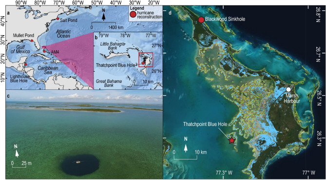
Figure 2.
Thatchpoint Blue Hole regional context. (a,b) Location of TPBH (red star) in the North Atlantic, as well as the location of some huricane reconstructions cited in this study (red circles, Basemap source: Esri Oceans). (c) Aerial photograph of TPBH collected by Pete van Hengstum in January 2015 using a DJI Phantom 3 with a mounted GoPro Hero3 digital camera. (d) NASA ARIA satellite flood proxy map of Abaco Island on September 4th, 2019 during the peak flooding of Hurriane Dorian (cat. 5, Saffir-Simpson)39. The general terrestrial boundaries for Abaco are indicated in yellow (DIVA-GIS)73, and Dorian induced flooding is shown in light blue. Optical satelitte imagery was obtained from ESRI basemap compiled satellite imagery.

