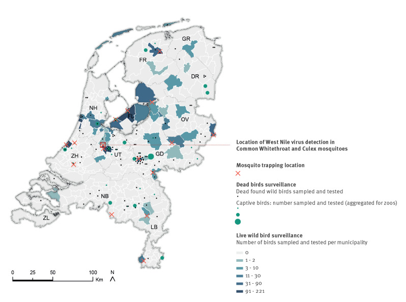
Figure 1.
Surveillance network for zoonotic viruses in birds and mosquitoes and location of West Nile Virus detection, the Netherlands, 2020
DR: Drenthe; FL: Flevoland; FR: Friesland; GD: Gelderland; GR: Groningen; LB: Limburg; NB: Noord Brabant; NH: Noord Holland; OV: Overijssel; UT: Utrecht; ZH: Zuid Holland; ZL: Zeeland.
Crosses indicate mosquito trapping locations. Dots indicate locations of dead birds collected in 2020. Captive dead birds are aggregated by zoo. The number of live birds sampled and tested in 2020 is indicated at the municipality level. Source administrative boundaries: Statistics the Netherlands (CBS). Created using ArcGIS 10.6 software by ESRI.

