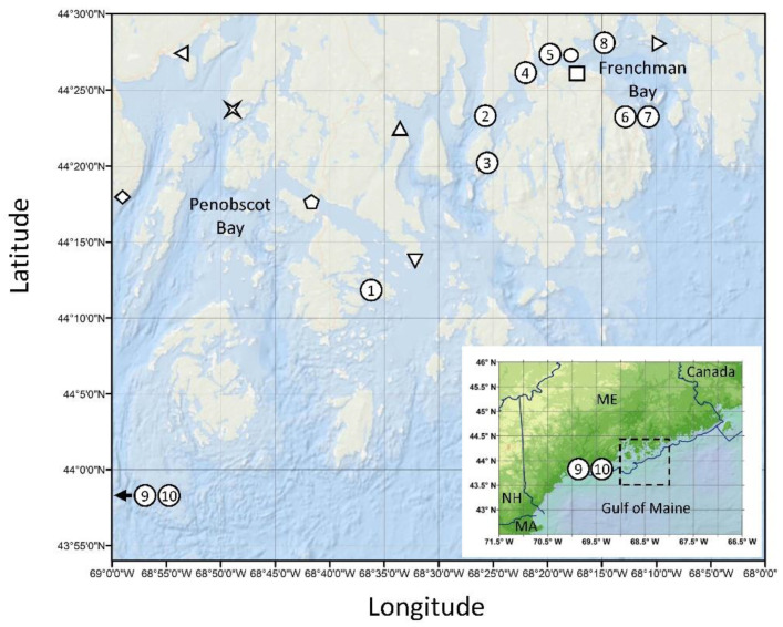
Figure 1.
Map of sampling locations during the 2016 Dinophysis norvegica bloom on the central coast of the Gulf of Maine, USA. Symbols indicate sampling locations for both water and shellfish and correspond to data in Figure 2: [◇] Lincolnville, [◁] Searsport, [  ] Dice Head, [⬠] Eggemoggin Reach, [△] Blue Hill Falls, [▽] Flye Point, [◯] Lamoine State Park, [☐] Salsbury Cove, [▷] Waukeag. Numbers indicate shellfish sampling only and correspond to data in Table 1: (1) Stinson Neck Causeway, (2) Oak Point, (3) Pretty Marsh Harbor, (4) Trenton Sea Plane Ramp, (5) Googins Ledge, (6,7) Bar Harbor, (8) Raccoon Cove, (9,10) Lumbo’s Hole (control site outside of bloom area). Abbreviations: ME—Maine, NH—New Hampshire, MA—Massachusetts. Sampling site coordinates provided in Table S1.

