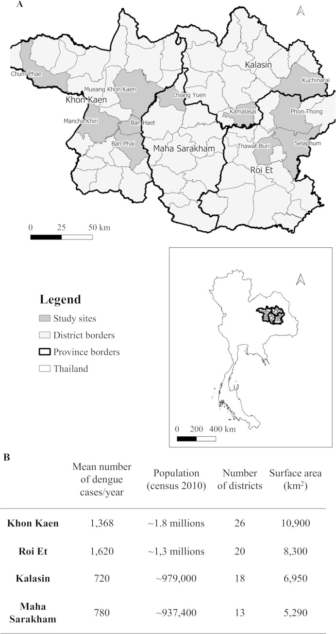
Fig 1. Map and characteristics of study sites of the case-control study in northeastern Thailand.
A: Location of four provinces and study districts in northeastern Thailand included in the case-control study. Map of study sites was built using QGis 3.10 software and shapefiles were obtained from the Humanitarian Data Exchange project [41] under the Creative Commons Attribution International 4.0 license (CC BY 4.0). B: Study area characteristics, population and average number of dengue cases per year from 2005–2019 [39].

