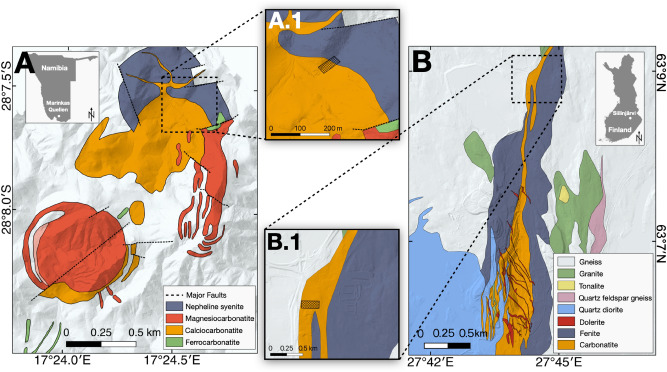
Figure 2.
(A) Geological map of the Marinkas Quellen carbonatite complex with an inset showing its location in Namibia. The geological map was modified after Smithies and Marsh22. (A.1) The zoomed-in area shows the footprint of the hyperspectral UAV-based survey. (B) Geological map of the Siilinjärvi carbonatite complex with an inset showing its location in Finland. The geological map was modified after the Geological Survey of Finland26. (B.1) The zoomed in area shows the footprint of the hyperspectral UAV-based survey. Both maps were fused with a digital elevation model (DEM) created with photogrammetry from own UAV-based data and produced in QGIS 3.12.

