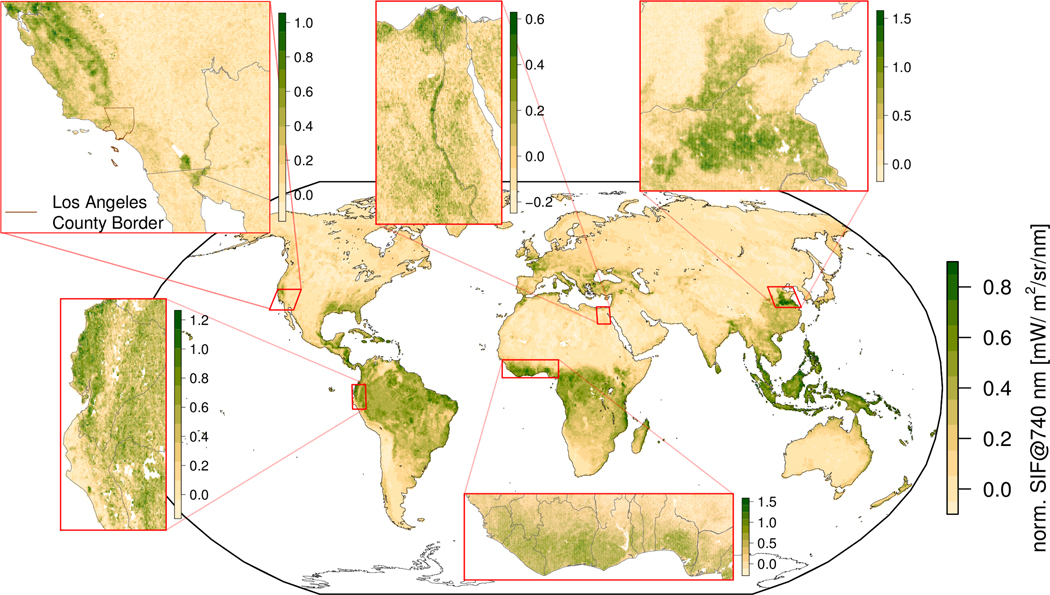
Figure 2.
The global SIF map is based on data acquired between 04/08/2018 and 04/15/2018 (114 orbits, 16M measurements over land). Retrieval results were normalized (Eq. 1) and gridded to a spatial resolution of 0.2° × 0.2°. The zoom-ins are gridded to 0.05° × 0.05°.

