
Figure 7.
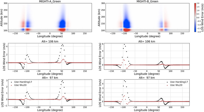
The retrieved MIGHTI‐A and MIGHTI‐B green line LOS wind error using symmetric airglow assumption (Harding17) and the correction using asymmetric airglow procedure (Wu20). (Top) The same as in Figure 6 (top) but for the green line case; (middle) the same as in Figure 6 (middle) but for 106 km, the highest altitude for which both daytime and nighttime data for the green line are available; (bottom) the same as the middle panels but for an altitude of 97 km, which is the closest altitude to the bottom layer of TIEGCM.