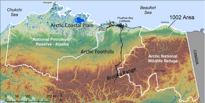
Fig. 1.

Topography and surface waters of Northern Alaska, USA, showing the National Petroleum Reserve–Alaska (NPR‐A) to the west, Prudhoe Bay oilfield roads, the Dalton Highway and Trans‐Alaska Pipeline extending south from Prudhoe Bay, and the Arctic National Wildlife Refuge (Arctic NWR) to the east (to the Canadian border). The 1002 Area within the Arctic NWR is shown with a dotted line.
