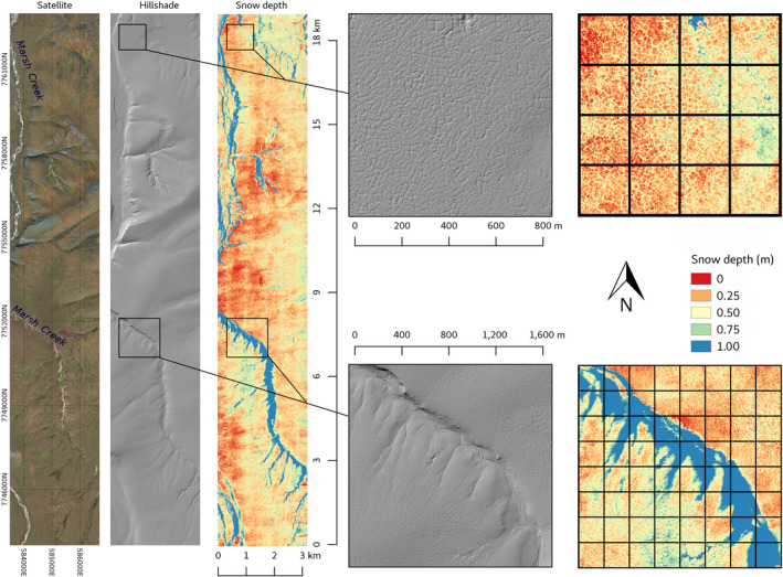
Fig. 5.

From left to right, summer terrain, winter aerial photograph, and snow depth calculated from airborne elevation surveys in April 2018 of a 3 × 19 km area centered on Marsh Creek, Arctic National Wildlife Refuge. The method is described in Nolan et al. (2015). The location of this imagery is shown by the orange rectangle in Fig. 2. The grid on the two inset maps on the right shows 200 × 200 m spacing as proposed for the seismic exploration (SAExploration 2018). The width of the lines approximating the average 10 m width of the seismic trails.
