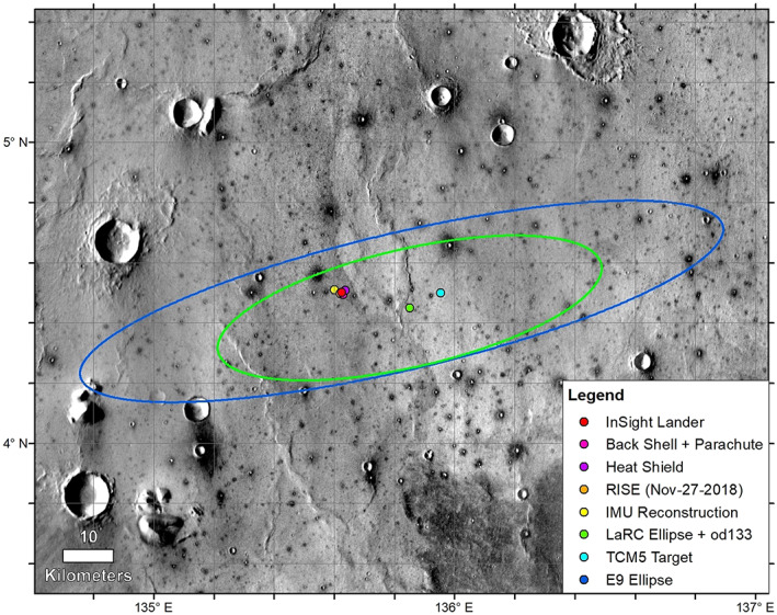
Figure 2.

The reference E9 landing ellipse (dark blue, 130 km × 27 km) (Golombek et al., 2017), with trajectory correction maneuver 5 (TCM5) course adjusted target, the last orbit determination solution and ellipse (LaRC green, 77.4 km × 23.2 km), the extrapolated IMU surface location, the RISE estimate from Sol 1 (4.49751° ± 0.00471°N, 135.6178693° ± 0.000337°E), and HiRISE‐based locations on 6 December 2018. Background image mosaic is from the daytime THEMIS infrared global mosaic at 100 m/pixel. The dominant surface is smooth Early Amazonian‐Hesperian plains deformed by north‐trending wrinkle ridges (suggesting subsurface basalt flows) with large impact craters (Golombek et al., 2017, 2018). Most craters larger than around 40 m but smaller than around 2 km are dark (indicating colder daytime temperatures and higher thermal inertia), rocky ejecta craters (Warner et al., 2017). These craters excavate strong coherent rock (basalt) from depths of 4–200 m depth, with a fractured regolith on top and weaker sediments beneath (Golombek et al., 2017, 2018).
