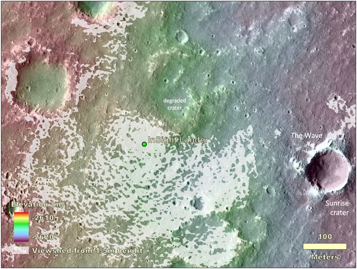
Figure 14.

Combined topographic and viewshed map overlain on a HiRISE image of the area within hundreds of meters of the InSight lander. The viewshed at a height of 1.5 m above the lander location is shown in white. Note Sunrise crater and eolian bedforms, The Wave, 400 m to the east. The topographic map is from a HiRISE stereo pair produced by Fergason et al. (2017) (InSightE17_C) produced during the landing site selection effort (Golombek et al., 2017).
