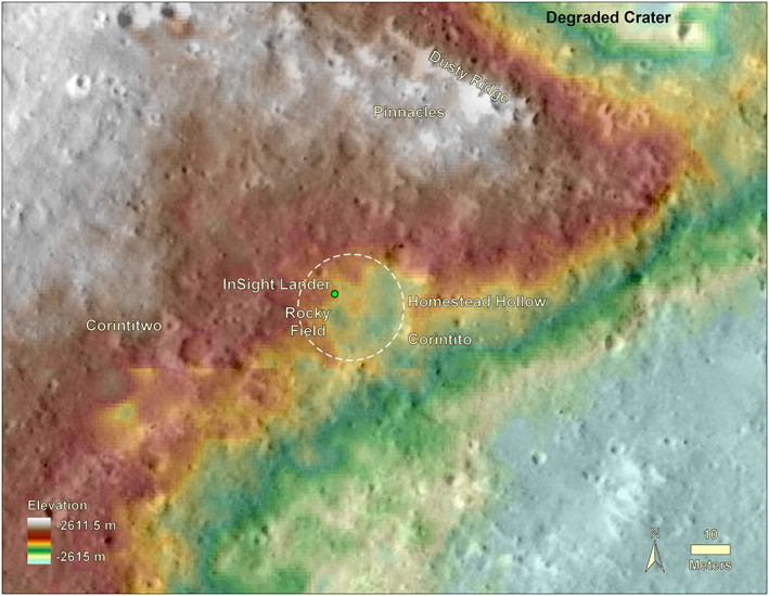
Figure 15.

Topographic map overlain on a HiRISE image of the area around InSight. The lander is located in the northwest portion of a 27 m diameter quasi‐circular depression, Homestead hollow (dashed circle). The hollow is around 0.3 m deep on average (varies from 0.2 to 0.5 m) with higher topography around it. Two Corinto secondary craters (Corintito and Corintitwo) are in view of the lander as are three rocks (The Pinnacles) and an eolian bedform (Dusty Ridge) to the north‐northeast. Note craters in widely varying states of degradation from very fresh (Corinto secondaries) to highly degraded Homestead hollow. Digital elevation model (color) from stereo HiRISE images from Fergason et al. (2017) (InSightE17_C).
