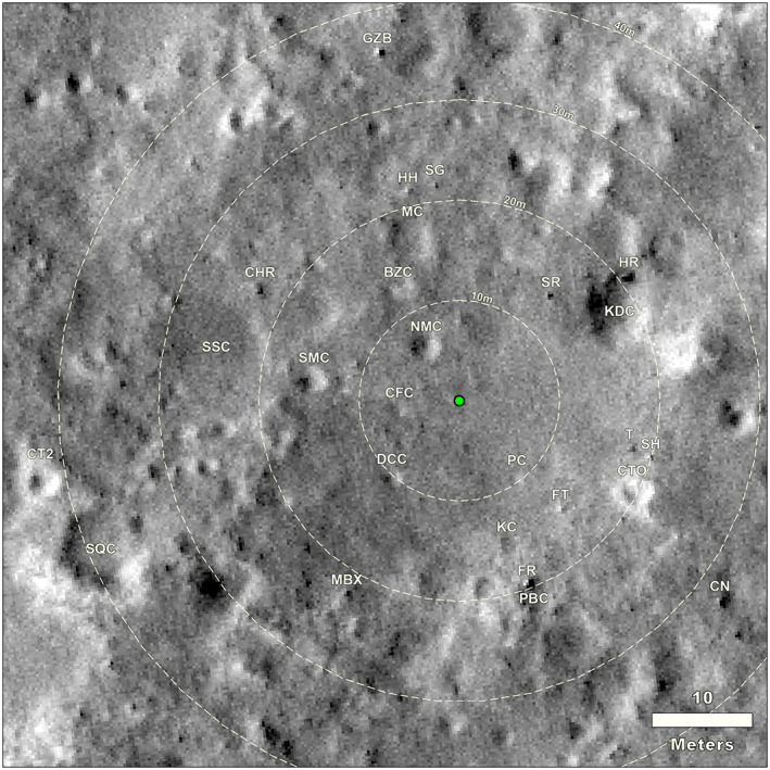
Figure 16.

HiRISE image of the area around the InSight lander (green dot) with craters and rocks that can be identified in both the panoramas (next figures) as well as this orbital image. Clockwise from due north (up on the image), abbreviations are as follows: SR is Slippery rock, HR is Hanging rock, KDC is Knee Deep crater, T is Table rock, SH is School House rock, CTO is Corintito crater, CN is Cone rock, FT is Flat Top rock, PC is Puddle crater, PBC is Peekaboo crater, FR is First rock, KC is Kettle crater, MBX is Mail Box rock, DCC is Deep Cut crater, SQC is Squash crater, CT2 is Corintitwo crater, CFC is Coffee crater, SMC is Smudge crater, SSC is Sunset crater, CHR is Churro rock, CPF is Campfire crater, BZC&H is Blast Zone crater and hollow, NMC is Near Miss crater, MC is Mole crater, HH is Hedgehog rock, GZB is Gazebo rock, and SG is Slug rock. HiRISE image number ESP_036761_1845, not map projected, that has been georeferenced into a map view.
