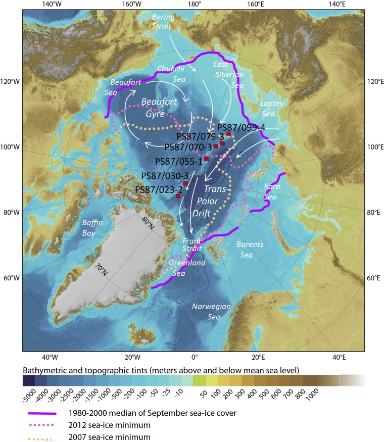
Fig. 1.
Map of the Arctic Ocean showing the limits of September sea ice (1980–2001 median, 2007 and 2012; cf. Snow and Ice Data Center https://nsidc.org/data/seaice_index/bist) and location of study sites PS87/023–2 (86°37.86'N and 44°52.45'W, 2439 m), PS87/030–3 (88°39.39'N and 61°25.55'W, 1277 m), PS87/055-1 (85°41.47'N and 148°49.47'E, 731 m). PS87/070-3 (83°48.18'N and 146°7.04'E, 1340 m), PS87/079–3 (83°12.09'N and 141°22.54'E, 1359 m), and PS87/099–4 (81°25.50'N and 142°14.33'E, 741 m). Background map from The International Bathymetric Chart of the Arctic Ocean (67). White arrows indicate major surface currents and sea-ice rafting routes.

