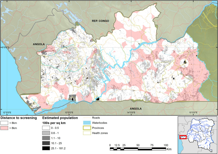
Fig 4. Map of estimated population within and beyond 8km distance to health facilities screening for HAT.
The geodata layers were obtained from CC-BY License compatible sources: The CGIAR SRTM 90m datasets (https://bigdata.cgiar.org/srtm-90m-digital-elevation-database/). Further geodata were downloaded from Digital Chart of the World through Diva-GIS (https://www.diva-gis.org/gdata) and OpenStreetMaps (http://www.openstreetmap.org) and rendered by the authors using ESRI ArcGIS following the PLOS guidelines (https://journals.plos.org/plosone/s/figures) or were supplied by PNLTHA. Data on population are from [19].

