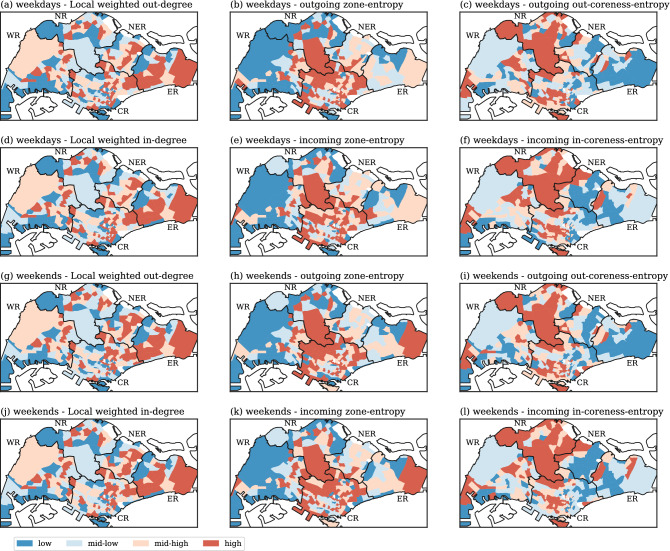
Figure 7.
Spatial distribution of the three key indicators: weighted degree, zone-entropy and coreness-entropy. Left column: local weighted in- and out-degrees; Central column: outgoing or incoming zone-entropy; Right column: outgoing or incoming coreness-entropy. First two rows: weekdays; Bottom two rows: weekends. The subzones are separated into four groups using the 25%, 50% and 75% percentile as cutoffs, thereby giving the “low”, “mid-low”, “mid-high” and “high” categories. Generated with Python (3.7.5), Matplotlib (3.2.1) and GeoPandas (0.7.0).

