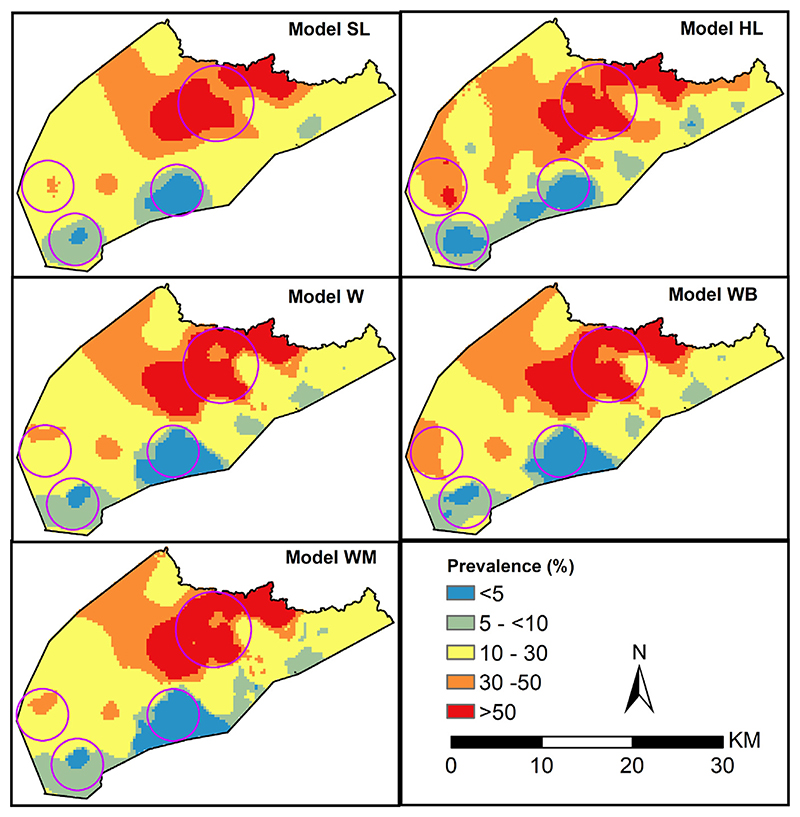
Fig. 7.
Predicted mean malaria prevalence at 0.3 × 0.3 km spatial resolution ranging from 0% (blue) to 83.2% (dark red) in 2010 for 5 geostatistical models based on school location (SL), gold standard model (HL) based on household location and three models accounting for locations uncertainty W, WB, WM. Circles show areas with differences.

