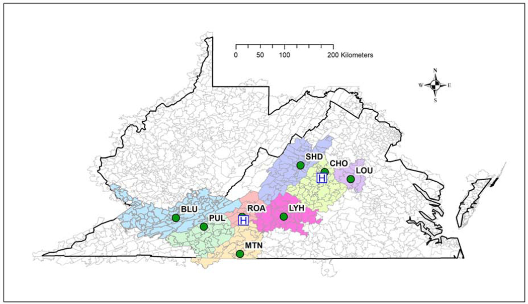
Figure 2.
Zip code tabulation areas of residents included in the study and associated with the following weather stations: Charlottesville-Albemarle County Airport (CHO); Roanoke-Blacksburg Regional Airport (ROA); Shenandoah Valley Regional Airport (SHD; Louisa County Airport (LOU); Lynchburg Regional Airport (LYH); Martinsville (Blue Ridge Airport) (MTN); Pulaski County Airport (PUL); and Mercer County Airport near Bluefield, WV (BLU). Weather data were recorded at the respective airports (green dots) and the hospital locations are indicated by an “H.”

