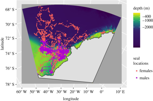
Figure 1.

Satellite tracks from 19 instrumented Weddell seals carrying CTD-SRDL tags deployed in February 2011 (10 females and 9 males). The tracks are colour-coded by sex. The background colour represents bathymetry (depth in metres at a 0.5 km resolution). The colour bar is scaled so that light areas represent the continental shelf and dark areas represent the deep ocean. There is a deep trough on the continental shelf at 40° W, the Filchner Depression. These are predicted locations from a correlated random walk model fitted to the original data, accounting for the estimated CLS Argos location error, using the foieGras package in R [51]. (Online version colour.)
