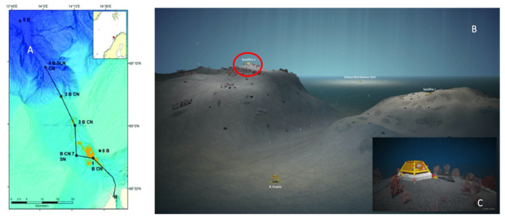
Figure 1.
Overview of the Lofoten-Vesterålen (LoVe) canyon area (from Aguzzi et al. [6]). (A) The bathymetric map with the extended cabled transect with nodes (black dots) numbered 1–7 for shallower (light blue) to deeper realms (dark blue) and connected by a marine cable (continuous line). Node 1 is located in the shallowest part of the trough (orange areas represent the cold water coral (CWC) reefs). (B) A 3D detailed representation of the area around Node 1, where satellite no. 2 with camera appears on top of a small mound (encircled in red). (C) Enlarged view of the areas surrounding the satellite #2, where Paragorgia colonies are schematized.

