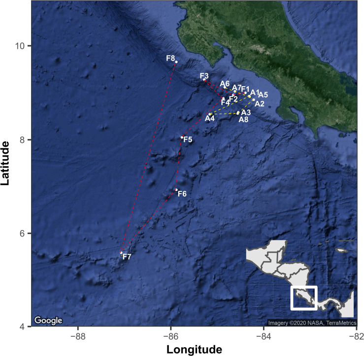
FIGURE 1.
The geographical location of sampling points in the Eastern Tropical Pacific of Costa Rica. The points indicated with the letter A and yellow line correspond to the route followed by the RV Atlantis and while letter F and red lines correspond to the route of RV Falkor. The map was generated with the ggmap package using a Google satellite image.

