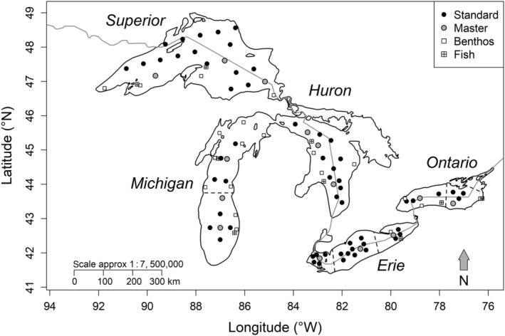
Figure 1.

Map of the Laurentian Great Lakes showing station locations for the Great Lakes National Program Office (GLNPO) long‐term monitoring program, including standard, master, benthos, and fish stations. Only standard and master stations were used for long‐term trend analysis. The gray line denotes the boundary between the United States and Canada, and dashed lines denote basin divisions for Lakes Michigan, Ontario, and Erie.
