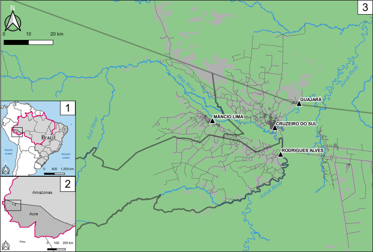
Fig 1. Location of the study site, the municipality of Mâncio Lima, Acre state, Brazil.
1: Brazilian Federal Units and the Amazon, also known as Legal Amazonia (magenta line in the map); 2: Acre and Amazonas states in dark and light gray, respectively, with the municipalities convered in this study highlighted in the weastern portion of the Fig 3: The municipalities of the upper Juruá Valley region: Mâncio Lima, Rodrigues Alves and Cruzeiro do Sul in Acre state and Guajará in Amazonas state. Dark thick lines represent the municipalities’ borders. The triangles show the town of each municipality, and in light green the forest cover in contrast with gray representing mostly deforested areas. Roads and streets are represented. Figure created with QGIS software version 3.14, an open source Geographic Information System (GIS) licensed under the GNU General Public License (https://bit.ly/2BSPB2F). Publicly available shape files provided from the Brazilian Institute of Geography and Statistics (IBGE) website (https://bit.ly/34gMq0S). Vegetated areas retrieved from Brazilian Institute for Space Research (2018) PRODES Project (https://bit.ly/33Q6wBD.) Roads and streets obtained from the Open Street Map Foundation website (https://bit.ly/36T2n1A). All utilized geographical data are under the Creative Commons Attribution License (CC BY 4.0).

