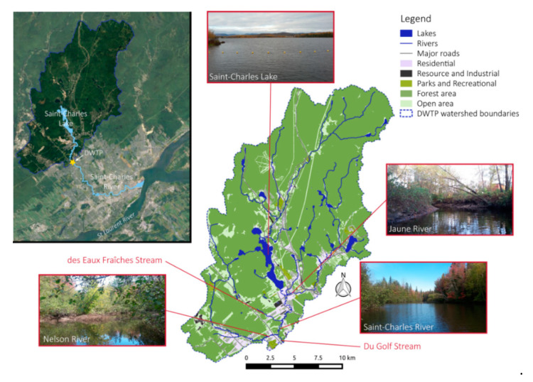
Figure 1.
Map of the studied area. Map of the Saint-Charles River showing the location and the visual appearance of the principal tributaries (the Saint-Charles Lake, the Jaune River, and the Nelson River). At the center, the map represents the land occupancy of the watershed before the Drinking Water Treatment Plant (DWTP), showing the most downstream sampling points of this study.

