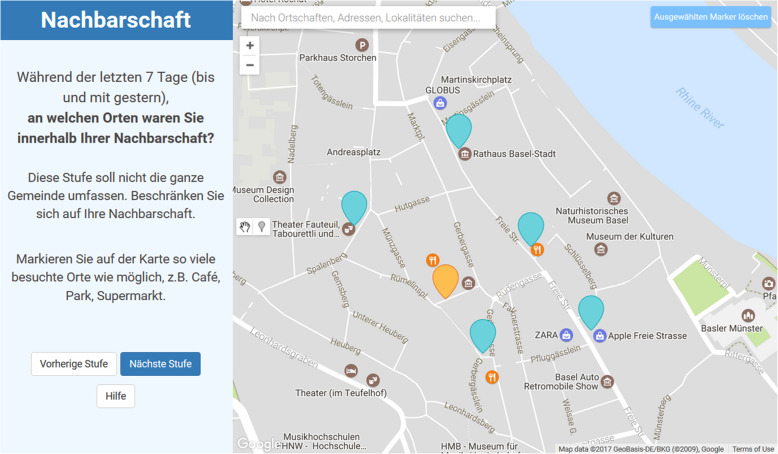
Fig. 1.
Screenshot of a fictitious life-space assessment by the interactive map-based assessment. It illustrates that the map application splits the screen into a left and right pane. The left side states questions, in the style of the following: “During the past 7 days (until yesterday), which places did you visit in your neighborhood?” The questions are supposed to be answered by marking points on the map on the right hand side of the screen. In this case, the (fictitious) participant marked his/her home in a previous step (orange marker) and five visited places in the neighborhood in the current step (blue markers). The map and its functionalities are created with the Google Maps JavaScript API and its Drawing library. The map design is a modified version of the Google Maps map, based on the Gowalla design from Snazzy Maps (Available at: https://snazzymaps.com/style/20/gowalla [Accessed November 1, 2020]).

