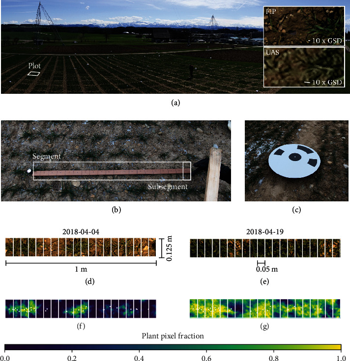
Figure 2.

Field experiment at the FIP site viewed from the corner of Lot 3 with a visualization of resulting ground sampling distance (GSD) for images taken by the FIP and UAS (a), segment and subsegment labeling in field with micro ground control points with 20 mm diameter at borders of a 1 m row and yard stick with marked 0.05 m subsegment (b), coded ground control points with 0.5 m diameter (c), images taken by the FIP dolly from 3 m distance with a GSD of 0.6 mm (d, e), and equivalent multiview images based on images taken by the UAS from 28 m distance with a GSD of 3 mm (f, g) displaying plant pixel fractions. These fractions indicate the probability of pixels to show plant parts. Fractions close to one correspond to dense canopies or plant parts close to the ground; values close to zero correspond to soil parts; intermediate values correspond to erect or sparse plant parts.
