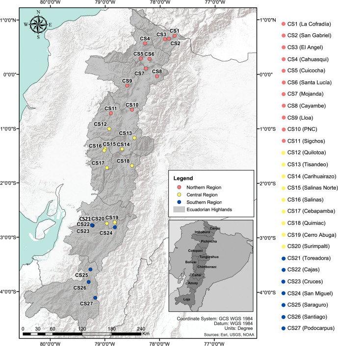
Fig 1. Map of Ecuador including the 27 V. floribundum Collection Sites (CS) in the Ecuadorian Highlands.
Mortiño individuals sampled from 27 different collection sites (CS), distributed along three latitudinal regions (northern, central and southern) represented by different marker colors in the map. The sampling range included all ten provinces of the Ecuadorian Highlands shown in the bottom right. The map was created using ArcGIS® software by Esri. ArcGIS® and ArcMap™ are intellectual property of Esri and are used herein under license. Copyright Esri. All rights reserved. For more information about Esri® software, please visit www.esri.com.

