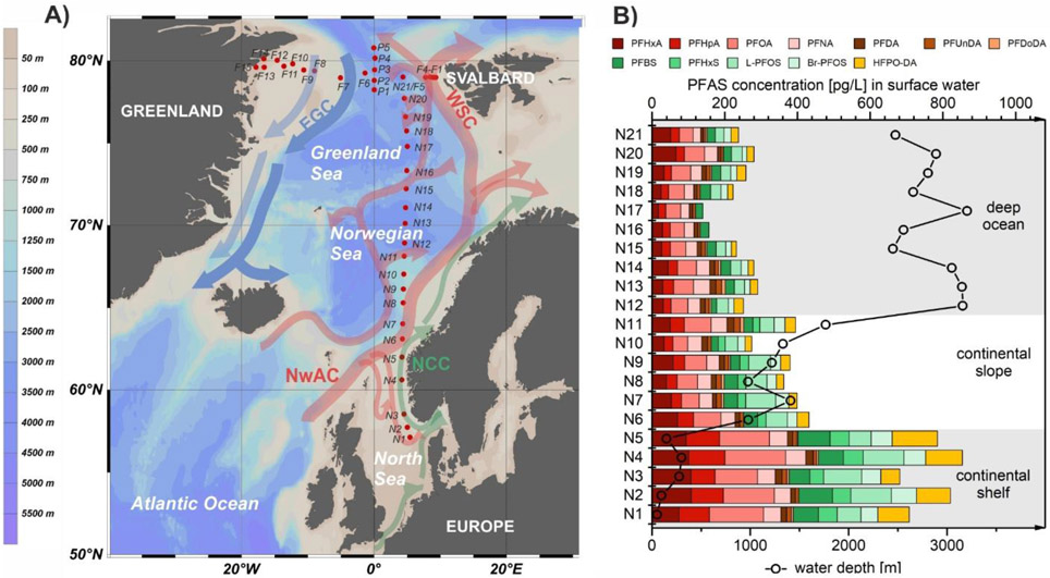
Figure 1:
A) Surface water sampling locations (red dots; samples taken at 11 m depth) along a latitudinal transect from the European continent to the Arctic Ocean (N1-N21), and a longitudinal (F1-F15) and latitudinal (P1-P5) transect within Fram Strait. Arrows represent ocean currents (NCC: Norwegian Coastal Current; NwAC: Norwegian Atlantic Current; WSC: West Spitsbergen Current; EGC: East Greenland Current).8,31 B) Surface water concentrations [pg/L] of detected PFASs along the sampling transect from Europe to the Arctic in connection with water depth [m] at the respective sampling sites.

