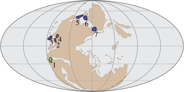
Figure 1.

Palaeogeographic map of sampled Sweetognathus populations during sea-level lowstands [11]. Colours (and numbers) correspond to time of diversification; green (1): Early Asselian, red (2,4): Late Asselian, blue (3,5,6,7): Sakmarian and Artinskian. The numbered localities refer to the locations of Sweetognathus populations used in this study: 1: Apillapampa Section, Bolivia; 2: Florence Limestone, Kansas; 3: Carlin Canyon, Nevada; 4: Tensleep, Wyoming; 5: Tingmissut Gorge Section, Melville Island; 6: East Blind Fiord, Ellesmere Island; 7: Dalny Tulkas Section, Russia. Species of Sweetognathus have a wider palaeogeographic range during sea-level highstands. (Online version in colour.)
