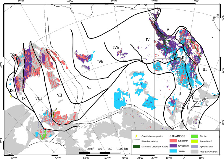
Fig. 1.
Map of the Saharides, which was made on a reconstructed north Africa/Arabia ensemble using the data reported in SI Appendix, Tables S1 and S2. Please see SI Appendix, Fig. S1 for the full tectonic map displaying the distribution of units and their tectonic environments. GPlates freeware (55) was used for the reconstruction. Four hundred forty five Ma reconstruction, as proxy to the Ediacaran reconstruction data from ref. 54.

