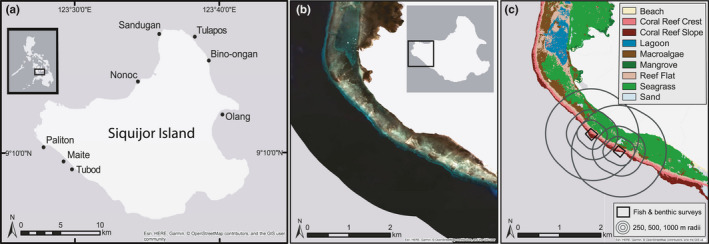
Figure 1.

Survey sites and mapping process of submerged habitat on Siquijor Island. (a) Map of sites (black circles) where fish and benthic assemblages were surveyed on coral reefs in April–July 2016. (b) Satellite imagery from one area of western Siquijor Island (San Juan) from the Planet imagery at 3‐m resolution showing the true color image. (c) Map of classified habitats derived from satellite imagery including survey locations of coral reef substrate and fish, and radii scales (250, 500, 1,000‐m) from which spatial metrics of adjacent habitat types were calculated
