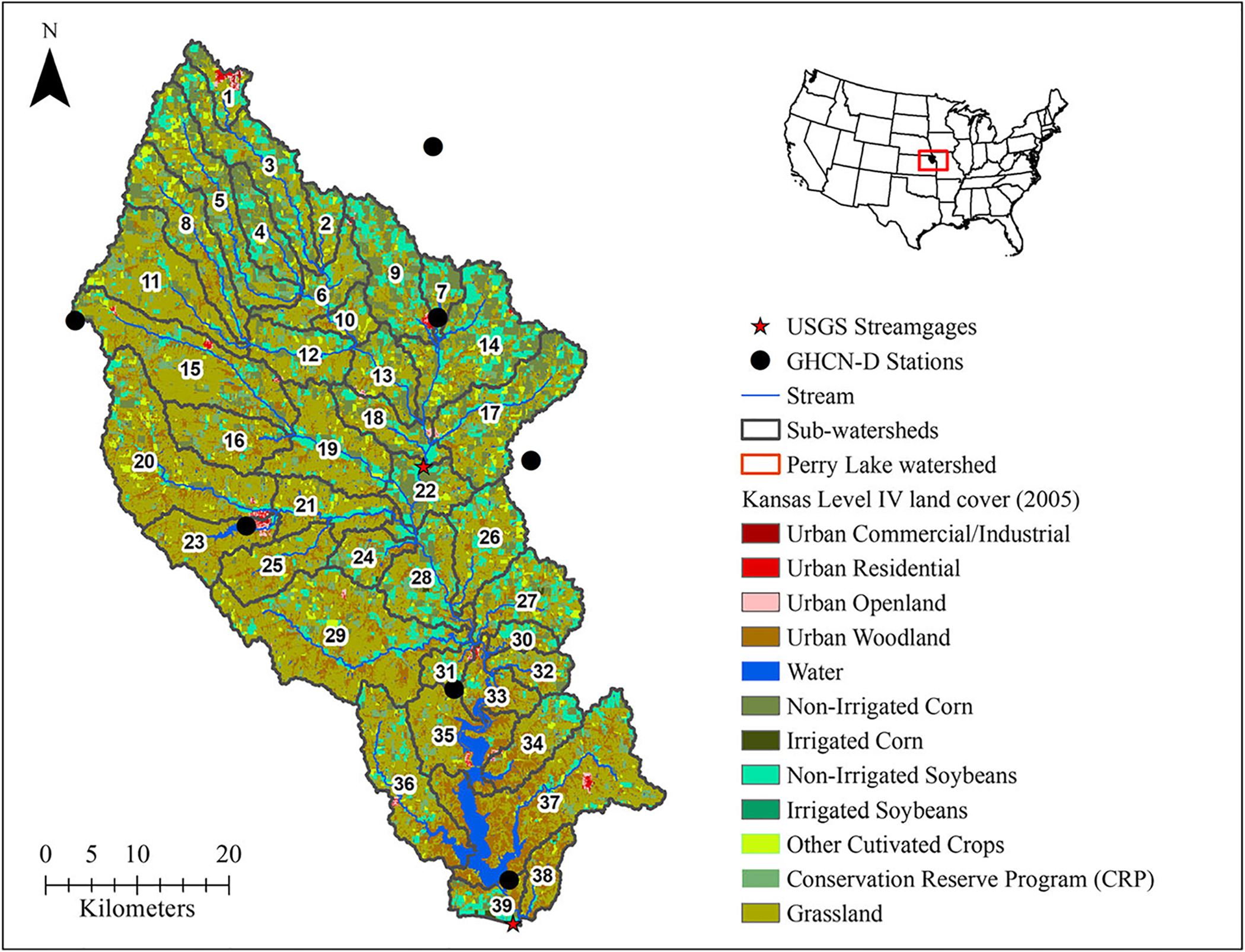
FIGURE 1.

Map of the Delaware watershed at Perry Lake with overlay of National Climatic Data Center (NCDC)- Global Historical Climatology Network-Daily (GHCN-D) stations (precipitation), United States (U.S.) Geological Survey gauge locations used for flow calibration, Soil and Water Assessment Tool (SWAT)-generated reach network, subwatersheds, and dominant land-use based on 2005 Kansas Level IV land cover.
