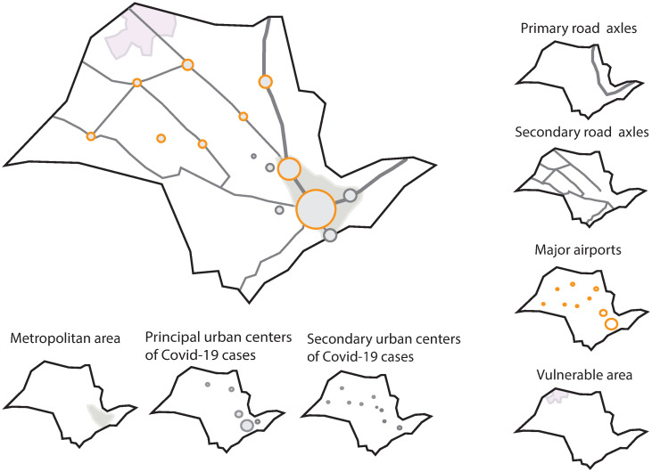
Fig 5. Elementary spatial structures associated with COVID-19 spread in São Paulo State, Brazil.
Around the main map, we display the structures that comprise it, such as road axes, regional airports, the metropolitan area of São Paulo city, municipalities keys as centers of disease dispersion from the metropolitan area to inner state, and municipalities where the oldest population of São Paulo lives.

