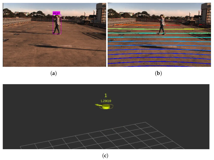
Figure 3.
Pedestrian tracking setup for the IRSU. (a) shows the detection of the target pedestrian within a camera image using YOLOv3. The lidar points are projected to the image frame with extrinsic calibration parameters. The projected points in (b) are colour coded based on their range to the sensor in 3D space. Those bold points indicate those hitting the ground plane. (c) demonstrates the tracking of the pedestrian in 3D space. The RTK antenna was hidden within the cap of the pedestrian to log GNSS positions as the ground truth.

