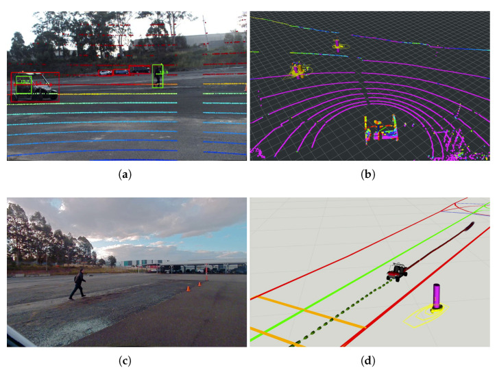
Figure 21.
The CAV started tracking a pedestrian running toward a crossing line of a marked pedestrian crossing in a lab environment based on ETSI CPMs from an IRSU. (a) shows the image frame from Cam #1 of the IRSU with projected lidar point cloud. (b,d) illustrate the tracking of the road users in 3D space in the IRSU and the CAV, respectively, and (c) shows the image captured by the front-left camera on the CAV. The pedestrian and the safety driver of the CAV are tracked and denoted by magenta pillars with confidence ellipse and arrows indicating their moving direction, while the vehicle is labelled as an orange pillar in the IRSU’s tracker. Only the running pedestrian was tracked in the GMPHD tracker running within the CAV, as depicted in (d), as the CAV itself and its safety driver are identified and removed from tracking based on the location of the received perceived objects after transformed into its local frame. The Lanelet2 map is also visualised in (d), where the pedestrian crossing is denoted by an orange rectangle. Furthermore, the odometry trajectory of the CAV is shown as a red line, and its planned path is denoted as a dotted green line in (d).

