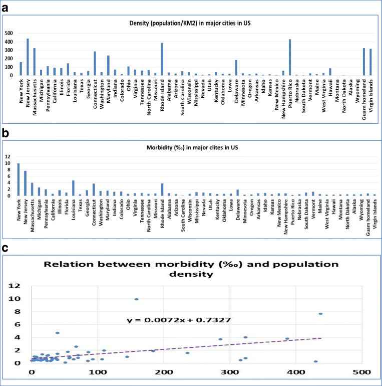
Fig. 2.
Population density and morbidity in 53 locations in the USA and its territories. a Population density in the 53 locations in the US states and territories. The number on vertical axis is the average number of persons per kilometer. Names of the states and territories are listed on the horizontal axis. b Disease morbidity rate in the 53 in the US states and territories. The number on vertical axis is the average rate of morbidity from COVID-19. Names of the states and territories are listed on the horizontal axis. c The relationship between the population density and disease morbidity. The number on vertical axis is the disease morbidity rate, and the horizontal axis is the number of persons per kilometer

