Figure 5.

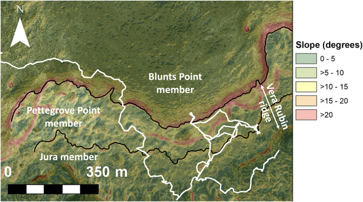
Slope map generated from HiRISE DEMs showing steep slopes bounding VRR. Black lines indicate stratigraphic member boundaries defined in Edgar et al. (2020).

Slope map generated from HiRISE DEMs showing steep slopes bounding VRR. Black lines indicate stratigraphic member boundaries defined in Edgar et al. (2020).