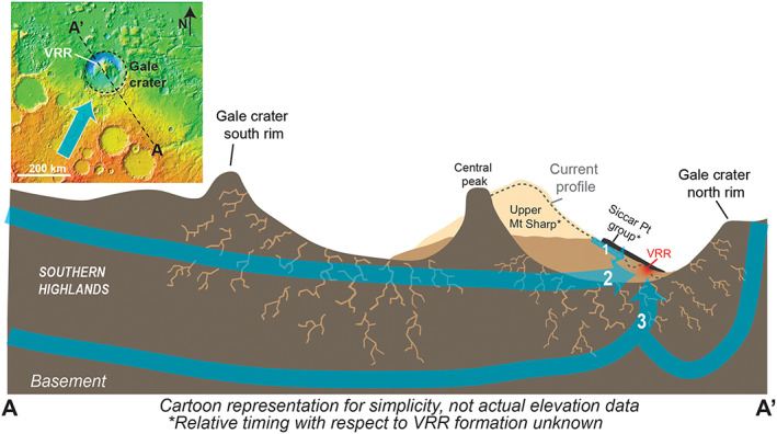
Figure 16.

(upper left) Regional topographic map with representation showing regional flow (blue arrow in inset) that likely passed into and across Gale (Irwin et al., 2005; Palucis et al., 2016). (bottom) Idealized cross section of Gale crater (distorted scales) locating Vera Rubin ridge (VRR) at the base of Mount Sharp and the representing the possible major pathways of water that may have contributed to diagenesis of the sediments. At the time of diagenesis VRR was not fully exposed as it is today. Note that the cross section A‐A′ lies approximately perpendicular to hypothesized Paths (2) and (3), but a component would have been in the paths shown. Path (1) follows relatively shallow subsurface flows off Mount Sharp that may have been directed down Gediz Vallis toward the current location of VRR. Path (2) depicts a path of groundwater that drains from the southern highlands into Gale, crossing Mount Sharp. Path (3) shows that in the floor of Gale, the deeper pathways of the drainage from the south or local infiltrating waters can ascend to the surface.
