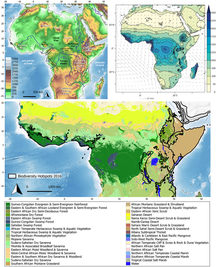
Fig 1.

The modern geophysical, climatic and vegetation setting of tropical Africa. (A) Topography of tropical Africa, modified from Guillocheau et al. (2018). Topographic and bathymetric data taken from the GEBCO 2020 Grid (doi: 10.5285/a29c5465‐b138‐234de053‐6c86abc040b9). Scale on bottom left is altitude in meters. Numbers refer to major rivers: 1, Niger; 2, Benue; 3, Ogooué; 4, Ubangi; 5, Uele; 6, Congo; 7, Zambezi; 8, Shire; 9, White Nile; 10, Blue Nile; 11, Nile. (B) Summed annual rainfall amount (colour‐shading, in millimetres) and averaged surface wind velocity (vectors, in m/s); rainfall data retrieved from the 1961–1990 climatology from the Climate Research Unit data set, wind velocities are averages from the 1989–2010 ERA‐Interim reanalyses [data from New et al. (2002) and Dee et al. (2011)]. (C) Major vegetation types across Tropical Africa following Sayre et al. (2013). Major divisions are shown according to Sayre et al. (2013). Delimitation of biodiversity hotspots taken from https://zenodo.org/record/3261807#.Xvu69lVKiUk (doi: 10.5281/zenodo.3261807).
