Figure 1.
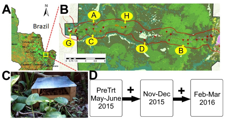
Map of the Mbaracayú Forest Biosphere Reserve (MFBR) and sampling efforts. (A) Partial map of Paraguay showing the location of the MFBR in Northeastern Paraguay on the border with Brazil. (B) Map showing the locations of the six grids, A, B, C, D, G, and H. Grids were approximately 120 by 120 m in size with 144 unique stations. Sherman traps were placed at each station on the ground and above the ground for a total of 288 for the first session and two on the ground and one above for subsequent post-treatment sessions (432 per grid). Grids B and H were the least disturbed sections of the MFBR, moderately disturbed habitats were found in grids A and D, and grids C and G were the most disturbed areas. (C) Example of feeding station used on each of three grids: H, D, and C. Sixteen feeding stations were placed in each grid and refilled weekly during two time periods. (D) Timeline of small mammal capture activities during study, where plus symbols (“+”) indicate periods when resources were added to the selected grids (grids H, D, and C).

