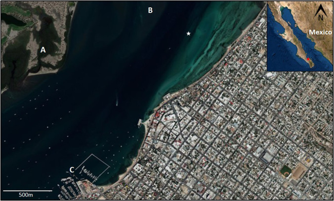
FIG. 1.
(Color online) Satellite image (ESRI) of the entrance to the Ensenada de La Paz showing the urban area and natural channel: mangroves in the sandbar (A); shallow shoal at the entrance of the channel (B); and marinas (C). The deeper navigation canal can be appreciated as a darker hue in the water. The white star marks the position of the autonomous recorder (24° 10′ 11.3160″ N and 110° 18′ 52.4880″ W) at 430 m from the coast. Boat traffic can be observed in the channel. Inset: Location of La Paz (red dot) in the Baja California peninsula, Mexico.

