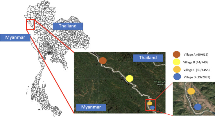
Fig 1. The study area consisting of four villages in Tha Song Yang district, Tak province of Thailand.
The number of participants and total population of each village are shown next to the village name as (participants/population). The map in this figure was produced using ArcGIS version 10.4 (Esri, Redlands, CA, USA). Source of shapefile: United Nations Office for the Coordination of Humanitarian Affairs https://data.humdata.org/dataset/thailand-administrative-boundaries. The inset maps in the figure were created using an open-source map from https://landsatlook.usgs.gov/.

