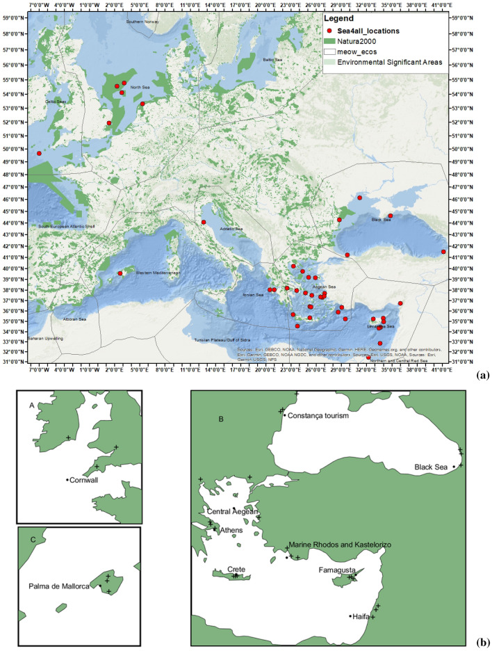
Figure 1.
General maps of the study area. (a) Environmentally significant areas and Natura 2000 sites in Europe shown together with the locations of the 43 pollution scenarios implemented in the context of the Sea4All project (www.sea4all-project.eu). (b) Relative location of sites in which river flow data were gathered from the Service for Water Indicators in Climate Change Adaptation (SWICCA) database. Figure (a) was created using ArcGIS (https://pro.arcgis.com/en/pro-app/get-started/get-started.htm#:~:text=ArcGIS%20Pro%20is%20the%20latest,elements%20of%20the%20user%20interface and https://www.marathondata.gr/). Natura2000 data are from http://www.eea.europa.eu/data-and-maps/data/natura-2/natura-2000-spatial-data/.

