
Figure 4.
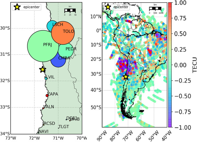
Left panel—Map of the earthquake ground shaking: the dimension of the station markers is proportional to the energy associated to the Up component of the earthquake ground shaking for some stations near the epicenter. It is evident that north placed stations are characterized by a higher energy than south placed ones. Right panel—Space-time sTEC variations at the SIPs for less than two hours (22:54:49-23:59:59 GPS time) on 16 September 2015 for all the satellites in view (cut-off angle set to 20) from all the 118 GPS stations.