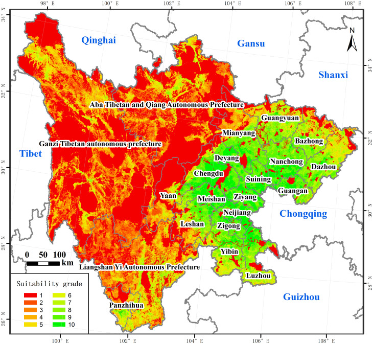
Fig 9. The spatial pattern of the land suitability.
The image was obtained by using ArcGIS 10.2 through the open-access data process. The base map outline was obtained by using ArcGIS 10.2 based on the Service Center of Standard Map (http://bzdt.ch.mnr.gov.cn/) and the number of the permission is GS (2020) 4621.

