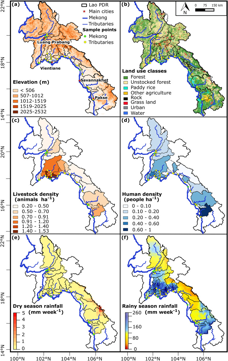
Figure 4.
Geographical and meteorological characteristics of the sampled watersheds in Lao PDR: (a) geomorphological features (Digital Elevation Model); (b) land use classes; (c) livestock density; (d) human density; (e) total rainfall recorded one week pre-sampling in March 2016 (mm week−1); (f) total rainfall recorded one week pre-sampling in July 2016 (mm week−1). Geographic coordinated system: WGS 1984, latitude and longitude in degrees. Altitudes of highest and lowest points in meters above mean sea level, from SRTM 90 m. Local populations and livestock per district were taken from the Lao PDR Population and Housing Census 2015. Rainfall data were obtained from the Multi-Source Weighted-Ensemble Precipitation (MSWEP V2); spatially distributed rainfall data was averaged per sampled watershed area. The land use map included land cover classes, namely: rock, water, grassland, and forest, and land use classes, namely: unstocked forest, paddy rice, other agriculture, and urban areas, making up a total of eight classes. According to FAO 2010, forests refer to areas of more than 0.5 ha with a canopy cover of more than 10% and trees higher than 5 m. Unstocked forests are forests with crown density lower than 20% resulting from exploitation for logging or shifting cultivation. Unfertile or degraded areas covered by grass are attributed to grassland category. Other agriculture refers to agricultural lands used for non-crop purposes like livestock grazing. Water class includes rivers and water reservoirs exceeding 10 m of width and 0.5 ha of surface area. Urban areas include permanent settlements like villages, towns, and roads having a width of more than 5 m. Maps generated with QGIS (version 2.6.1; https://www.qgis.org) and edited with Inkscape (version 0.92.4; https://inkscape.org).

