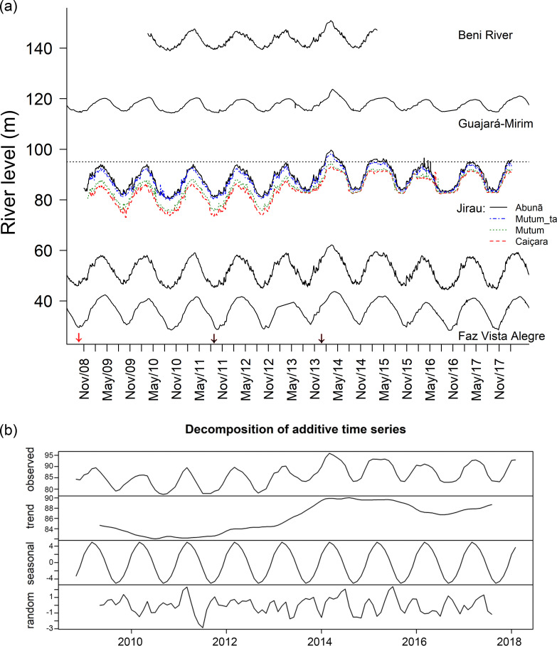
Fig 3. Water level recorded in different portions of the Madeira River between 2008–2019.
(a) Beni River = UHE Jirau Jusante Rio Beni, station # 15318000 (130 m altitude); Guajará-Mirim, station # 15250000 (109.3 m); Jirau stations: initial (Caiçara), middle (Mutum Tamborete, Mutum) and final (Abunã) sections of the Jirau reservoir before (2008–2013) and after reservoir filling (2013–2018); Porto Velho, station # 15400000 (42.5 m); Faz Vista Alegre = Fazenda Vista Alegre, station # 15860000 (20 m). (b) One-decade time series additive decomposition observations of the Madeira River water level (2008–2018) in the initial section of the Jirau reservoir (Caiçara), indicating estimated trends, seasonal pattern and time series random component. The red arrow indicates the start of construction of the hydroelectric dams on the Madeira River (September 2008) and the black arrows indicate the final stages of filling the Santo Antônio (September 2011) and Jirau (November 2013) reservoirs. Data provided by ANA at the HidroWeb Portal (http://www.snirh.gov.br/hidrotelemetria); Jirau data provided by ESBR (Energia Sustentável do Brasil).

