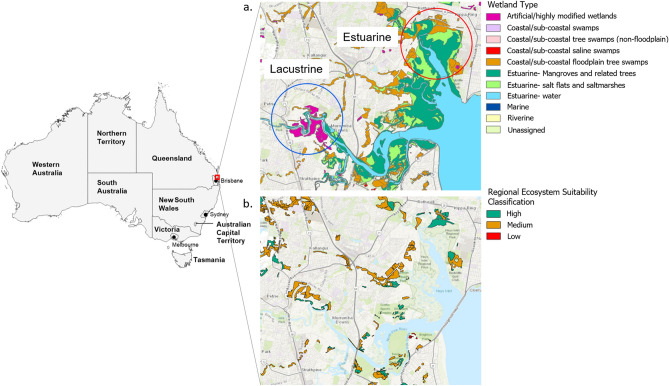
Figure 1.
(a) Location of the study area in southeast Queensland, Australia, and summary of primary water bodies present in each surveyed environment. (b) Location and ecosystem suitability classification of koala habitat in the study area as of the most recent state-wide classification (January 2020)7. Wetland70 and koala habitat71 GIS shapefiles were obtained through the QSpatial Catalogue (http://qldspatial.information.qld.gov.au/). Base layer of the region area sourced from Esri World Imagery72. This figure was created using the ArcGIS Pro software suite (version 2.4.2, https://www.esri.com/en-us/arcgis/products/arcgis-pro).

