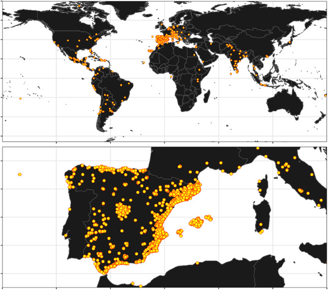
Figure 1.
Geographical diversity of the submitted images based on the provided geolocation tags. It can be clearly seen that while the vast majority of the Mosquito Alert participants are based in Europe (particularly Spain), images were taken all over the world. The map was made with Natural Earth public domain map data (https://www.naturalearthdata.com/) using the rnaturalearth package version 0.1.024 in R version 4.0.225 (https://www.R-project.org/).

