. 2021 Mar 4;18:E20. doi: 10.5888/pcd18.200362

Figure.

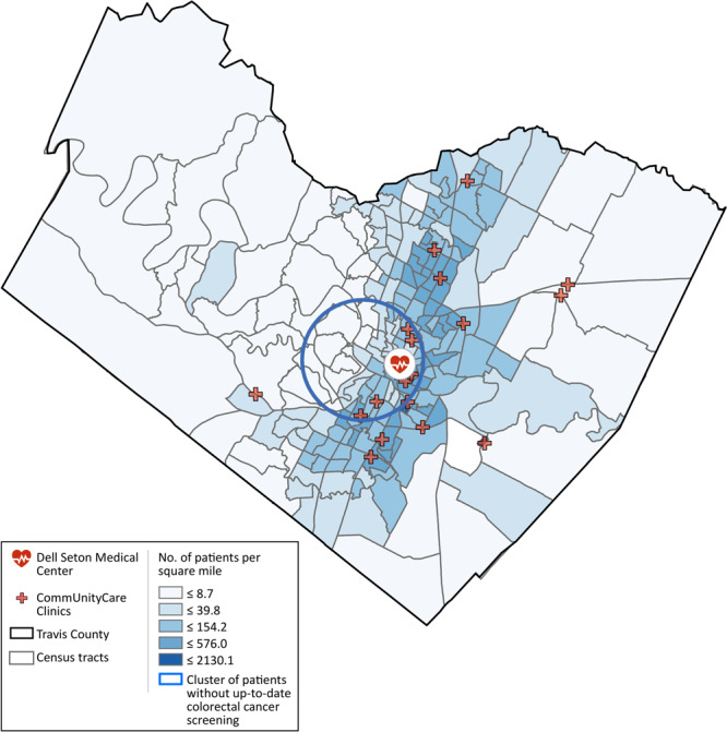
The map shows locations of medical facilities serving patients in Travis County and the density of the 21,923 geocoded patients per square mile at the census tract level. The circle near the center shows the area where levels of colorectal cancer screening are low, relative to patients from areas outside of the identified cluster but also served by the federally qualified health centers system in the county.

Medical facilities serving patients in Travis County, Texas and density of geocoded patients per square kilometer at the census tract level. A cluster shows levels of colorectal cancer screening was significantly lower, relative to patients from areas outside of the cluster but also served by the system of federally qualified health centers in the county. Radius of the circle is 4.0 miles.